Volcanology
Understanding our Planet, assessing natural hazards and harnessing georesources are the core mission of the Volcanology Research Group. A bold vision that permeates our applied and discovery research programs.
The Volcanology group profile page on Digital.CSIC.
Presentation
Our research is dedicated to understanding the structure and evolution of the Earth, in particular volcanic and magmatic systems. We study Earth structure and dynamics, in particular lithospheric processes, with a strong focus on rock and magma rheology, fluid-rock interactions and rates of processes. We utilize a wide range of geological and geophysical techniques, along with advanced analytical and numerical methods. We use this knowledge to assess earthquake and volcanic hazards, and to better harness georesources.
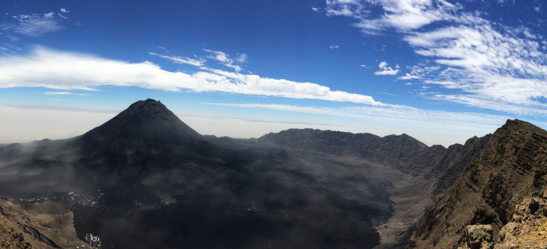
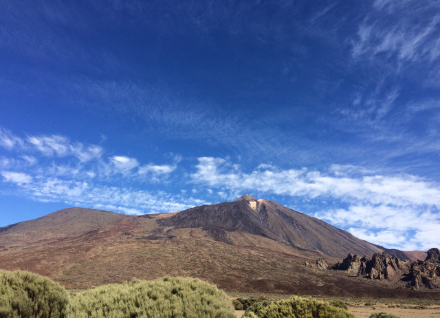
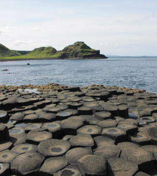
Due to our unique location on the Island of Tenerife (the third largest volcano on Earth), our investigations focus on ocean island volcanism. But, we have a wide range of research interests and we actively work on other type of volcanism and different tectonic settings.
Research lines
Magma dynamics: Generation, transport and eruption
Our research aims to contribute to answer questions on the magma dynamics as: why or at what rate magmas are generated?; how magmas became mobile?; or what controls the stagnation or migration towards the surface before eruptions?
Volcanic processes and hazards
Our group is world leading in the use of satellite radar interferometric (InSAR) for imaging Earth’s surface to measure ground deformation due to a variety of geophysical processes. We develop analytical and numerical models for the propagation and storage of magma.
Geodynamics: Lithosphere-Asthenosphere evolution in space and time
Our research aims at a quantitative understanding of deformation processes affecting the lithosphere (kinematics and rheological laws). It attempts to integrate observation from instantaneous single earthquakes and eruptions to the formation of volcanoes at geological time scale.
Georesources: interaction of rock and fluids in the Earth’s crust
This research line works towards holistic approaches to detect and monitor changes in geological reservoirs, mainly from a geomechanical approach (deformation and fluid flow coupling).
PhD & MSc. Thesis
Surface landscape processes under Earth's changing climate analyzed using satellite radar interferometry
Abstract:
The evolution of the Earth’s surface is shaped by a complex interplay of the lithosphere, atmosphere, biosphere, and hydrosphere, with climate playing a crucial role in driving processes such as rock weathering, erosion, and tectonic shifts. The rapid changes observed in the modern climate, driven by anthropogenic carbon emissions, have led to a notable increase in global temperatures with a rise of over 1.5°C since pre-industrial times. This dramatic shift in the global climate is expected to significantly impact Earth's surface processes, reshaping landscapes in unprecedented ways.
Utilizing advanced remote sensing techniques, particularly Interferometry of Synthetic Aperture Radar (InSAR), this thesis examines two landform that demonstrate significant sensitivity to rapid changing environmental conditions: salt glaciers in the Dead Sea region and cryovolcanism in Arctic permafrost. Over a period of 9.5 years, InSAR data was employed to investigate the dynamics of Mt. Sedom’s salt glacier, revealing both long-term uplift patterns and short-term responses to seasonal atmospheric changes, as well as reactions to significant rainfall events. Additionally, the study focused on explosive gas emission craters (GECs) in Arctic permafrost, using remote sensing data to distinguish between traditional pingos and rapidly formed GEC mound-predecessors. These works not only highlight the importance of advanced remote sending technologies in monitoring Earth’s surface dynamics, which also enhances our understanding of linkage between climate change and landscape evolution.
Lastly, the challenges associated with handling large-scale SAR datasets were recognized in the above studies. As a result, a novel compression strategy was developed for complex SAR images, facilitating efficient data management without compromising analytical accuracy. This advancement enhances the accessibility and efficiency of InSAR analyses, paving the way for more comprehensive monitoring of Earth's rapidly changing landscapes.
Dirigido por Pablo J. González (CSIC), Alex Webb (Free University Berlin) y Binzheng Zhang (University of Hong Kong).
Man Wai Yip
Surface deformation constraints on slow fault slip behavior during shallow continental seismic swarms
Site scale slow moving landslides: characterization by monitoring and modelling
Los deslizamientos de ladera son un peligro natural a nivel global. Pueden ocurrir bajo multitud de condiciones y son capaces de provocar una gran cantidad de pérdidas de vidas humanas e importantes daños económicos. La definición general de deslizamiento incluye una amplia variedad de fenómenos con características y comportamientos mecánicos propios. Entre esta diversidad de tipologías, los deslizamientos lentos de ladera se caracterizan por alcanzar velocidades de hasta varios centímetros/año y porque la rotura se desarrolla a lo largo de planos de cizalla. Pueden llegar a producir un gran impacto en zonas urbanas e infraestructura y ser precursores de movimientos más rápidos y catastróficos.
La heterogeneidad y complejidad de los fenómenos de inestabilidad de laderas exigen una nomenclatura y sistema de clasificación universales que puedan ser utilizados por toda la comunidad científica y técnica. La identificación preliminar del tipo de movimiento y principales características, tanto espaciales como temporales, es fundamental para poder diseñar sistemas de monitorización óptimos y para realizar la hipótesis del sistema a modelar.
Monitorizar los desplazamientos de un deslizamiento sirve para estudiar y controlar su actividad. En la actualidad es posible medir desplazamientos de la superficie terrestre mediante técnicas de teledetección, entre las cuales destaca la interferometría diferencial avanzada radar de satélite (A-DInSAR), que utiliza imágenes radar adquiridas de forma periódica bajo cualquier condición climática y permite monitorizar deformaciones complejas con precisión sub-centimétrica. En este trabajo se examina la integración de esta técnica en los sistemas de monitorización geotécnica de laderas.
Los modelos físicos se emplean para elaborar análisis retrospectivos (back analysis) del movimiento de deslizamientos y predicciones cuantitativas. Este trabajo explora los beneficios de realizar análisis en 3 dimensiones, aprovechando la versatilidad de los programas de elementos finitos y la información obtenida de los sistemas de monitoreo para calibrar y validar los modelos. Se presenta una metodología avanzada que reproduce la cinemática de deslizamientos lentos de ladera activos en 3D.
En conjunto, esta tesis doctoral presenta una guía práctica integral para estudiar deslizamientos lentos de ladera a escala local, basada en la clasificación detallada del fenómeno, monitorización mediante técnicas A-DInSAR y modelos numéricos en 3D.Site scale slow moving landslides: characterization by monitoring and modelling
Premio de la Fundación J. García-Siñeriz a la Mejor Tesis en Geofísica
Pablo J. González, codirigido con Jose Fernández (CSIC - Instituto de Geociencias) y Jose A. Fernández-Merodo (Instituto Geológico y Minero de España - IGME)
Guadalupe Marina Bru Cruz
Funding

GASPOF: Pervasive gas sensing using optical fibers, as part of the communication network of the future
En Ejecución
Estudio de los mecanismos que controlan el desencadenamiento, aceleración y parada de mega-deslizamientos en flancos de islas oceánicas - VOLCAMOTION
Pablo José González y María Charco (Instituto de Geociencias)
En Ejecución
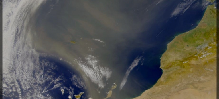
AeroExtreme - Study on Extreme Aerosol Events of desert and volcanic origin in the tropical & subtropical North Atlantic
Sergio Rodríguez González
En Ejecución

Detecting and Modelling Volcanic Surface Deformation over African Volcanoes using ALOS-2 and ALOS-4 satellite radar interferometry
En Ejecución
GEMMA – improving GEodynamic Models in MAcaronesia by reconciling geodetic, geophysical and geological data
Dr. Rui Fernandes (UBI, Portugal).
En Ejecución

Caracterización de los procesos de enfriamiento materiales volcánicos durante la fase post-eruptiva de la erupción de Cumbre Vieja
Finalizado
Procesos y peligrosidad ligados a la removilización de la ceniza
Finalizado
Caracterización remota de variaciones de almacenamiento de agua subterránea usando Observaciones geofísicas y Modelado Poroelástico de Acuíferos bajo condiciones de Compactación y flujo Transitorio (COMPACT)
El proyecto “Caracterización de variaciones de almacenamiento usando Observaciones geofísicas y Modelado Poroelástico de Acuíferos bajo condiciones de Compactación y flujo Transitorio” (COMPACT -…
Finalizado
Reducción del riesgo por erupciones volcánicas a nivel global usando observación desde el espacio y nuevos modelos dinámicos de sistemas magmáticos
Este proyecto desarrollará un sistema novedoso que combina observaciones por satélite y simulaciones geofísicas capaz de caracterizar de forma más realista la dinámica que controla la…
Pablo J. González
Finalizado
People

Publications
Spatial and Temporal Analysis of Temperature and Gaseous Emission Inside a Gallery in An Active Volcanic Island (Tenerife, Canary Islands)
In Tenerife there are a vast number of sub-horizontal blind water mines, called “galleries”. Seven air and soil temperatures and CO2 concentration profiles in air were carried out inside the Río de Guía gallery (hereinafter RdG). An anomalous stable maximum temperature point (hereinafter MTP) was found around 2000 m from the entrance. During the warm period, a clear CO2 stagnation was detected before MTP, showing concentrations up to 14,000 ppm. In order to study gas emission and its dynamics inside the gallery, four stations were deployed around MTP. All stations recorded air and soil temperatures, and CO2 and Rn concentration in air from November 2009 to January 2011. After analyzing this dataset, it was possible to characterize the influence of MTP. This thermal anomaly divided the gallery into two sections. In the cold period, the outer section located outwards from MTP became colder while the inner section warmed up owing to a less heat transfer into the deepest part of the gallery. There were several short periods when variations in barometric pressure created an advection movement that was able to temporally change the gas behavior inside the gallery. Two soil gas samples were taken around MTP and their δ13C (CO2) ratios suggested a magmatic origin. All data were combined to create a model for the gas and thermal dynamics inside the gallery. This model, together with identification of background levels in each parameter, allows to identify any anomalous signal that could be elated with changes in volcanic activity.
Torres-González, Pedro; Moure-García, David; Luengo-Oroz, Natividad; Villasante-Marcos, Víctor; Soler, Vicente; Iribarren, Ilaskiñe; Jiménez-Abizanda, Ana; García-Fraga, José
Geochemical signals related to the 2011–2012 El Hierro submarine eruption
On 10 October 2011, a submarine volcanic eruption began 2 km south of the island of El Hierro (Canary Islands, Spain). It was the first eruption after 40 years of quiescence in the Canarian archipelago. Since mid-July 2011, a multiparametric network has been deployed by the Instituto Geográfico Nacional (hereinafter IGN)to monitor volcanic processes. The data recorded by five stations, measuring the air and soil temperature, CO and radon concentration in the air inside four galleries and one well, are the focus of the present paper. Two important anomalies were found that improve comprehension of the volcanic process. First, a clear increase in CO concentration in one gallery (from 825 ± 19 to 2305 ± 35 ppm)which seems to be mainly controlled by ground deformation measured during the unrest period preceding the eruption. Second, a relationship between radon concentration in air in a well located in the northern side of the island with seismic energy release (several peaks with up to 115% increase), and ground deformation (50% growth in background level), also before the eruption onset. Lastly, changes in radon concentration during eruptive period seem to be modulated by seismic activity (increases up to 233%), which in turn is likely related to variations in magma rheology.
Torres-González, Pedro; Moure-García, David; Luengo-Oroz, Natividad; Villasante-Marcos, Victor; Iribarren, Ilaskiñe; Blanco, M. José; Soler, Vicente ; Jiménez-Abizanda, García-Fraga, José
SenDiT: The sentinel-2 displacement toolbox with application to glacier surface velocities
Satellite imagery represents a unique opportunity to quantify the spatial and temporal changes of glaciers world-wide. Glacier velocity has been measured from repeat satellite scenes for decades now, yet a range of satellite missions, feature tracking programs, and user approaches have made it a laborious task. To date, there has been no tool developed that would allow a user to obtain displacement maps of any specified glacier simply by establishing the key temporal, spatial and feature tracking parameters. This work presents the application and development of a unique, semi-automatic, open-source, flexible processing toolbox for the retrieval of displacement maps with a focus on obtaining glacier surface velocities. SenDiT combines the download, pre-processing, feature tracking, and postprocessing of the highest resolution Sentinel-2A and Sentinel-2B satellite images into a semi-automatic toolbox, leaving a user with a set of rasterized and georeferenced glacier flow magnitude and direction maps for their further analyses. The solution is freely available and is tailored so that non-glaciologists and people with limited geographic information system (GIS) knowledge can also benefit from it. The system can be used to provide both regional and global sets of ice velocities. The system was tested and applied on a range of glaciers in mainland Norway, Iceland, Greenland and New Zealand. It was also tested on areas of stable terrain in Libya and Australia, where sources of error involved in the feature tracking using Sentinel-2 imagery are thoroughly described and quantified.
Nagy, Teodor; Andreassen, Liss M.; Duller, Robert A.; González, Pablo J.
The 2014–2015 eruption of Fogo volcano: Geodetic modeling of Sentinel‐1 TOPS interferometry
After 20 years of quiescence, Fogo volcano erupted in November 2014. The eruption produced fast‐moving lava flows that traveled for several kilometers and destroyed two villages. This event represents the first episode of significant surface deformation imaged by the new European Space Agency's Sentinel‐1 satellite in its standard acquisition mode, Terrain Observation by Progressive Scans (TOPS), which differs from that of previous synthetic aperture radar (SAR) missions. We perform a Bayesian inversion of Sentinel‐1 TOPS SAR interferograms spanning the eruption and accurately account for variations in the TOPS line‐of‐sight vector when modeling displacements. Our results show that magma ascended beneath the Pico do Fogo cone and then moved laterally toward its southwestern flank, where the eruptive fissure opened. This study provides important insights into the inner workings of Fogo volcano and shows the potential of Sentinel‐1 TOPS interferometry for geophysical (e.g., volcano monitoring) applications.
González, Pablo J.; Bagnardi, Marco; Hooper, Andrew J.; Larsen, Yngvar; Marinkovic, Petar; Samsonov, Sergey V.; Wright, Tim J.
Magma storage and migration associated with the 2011–2012 El Hierro eruption: Implications for crustal magmatic systems at oceanic island volcanoes
[1] Starting in July 2011, anomalous seismicity was observed at El Hierro Island, a young oceanic island volcano. On 12 October 2011, the process led to the beginning of a submarine NW‐SE fissural eruption at ~15 km from the initial earthquake loci, indicative of significant lateral magma migration. Here we conduct a multifrequency, multisensor interferometric analysis of spaceborne radar images acquired using three different satellite systems (RADARSAT‐2, ENVISAT, and COSMO‐SkyMed (Constellation of Small Satellites for Mediterranean Basin Observation)). The data fully captures both the pre‐eruptive and coeruptive phases. Elastic modeling of the ground deformation is employed to constrain the dynamics associated with the magmatic activity. This study represents the first geodetically constrained active magmatic plumbing system model for any of the Canary Islands volcanoes, and one of the few examples of submarine volcanic activity to date. Geodetic results reveal two spatially distinct shallow (crustal) magma reservoirs, a deeper central source (9.5 ± 4.0 km), and a shallower magma reservoir at the flank of the southern rift (4.5 ± 2.0 km). The deeper source was recharged, explaining the relatively long basaltic eruption, contributing to the observed island‐wide uplift processes, and validating proposed active magma underplating. The shallowest source may be an incipient reservoir that facilitates fractional crystallization as observed at other Canary Islands. Data from this eruption supports a relationship between the depth of the shallow crustal magmatic systems and the long‐term magma supply rate and oceanic lithospheric age. Such a relationship implies that a factor controlling the existence/depth of shallow (crustal) magmatic systems in oceanic island volcanoes is the lithosphere thermomechanical behavior.
González, Pablo J.; Samsonov, Sergey V.; Pepe, Susi; Tiampo, Kristy F.; Tizzani, Pietro; Casu, Francesco; Fernández, José; Camacho, Antonio G.; Sansosti, Eugenio
Himalayan megathrust geometry and relation to topography revealed by the Gorkha earthquake
The Himalayan mountain range has been the locus of some of the largest continental earthquakes, including the 2015 magnitude 7.8 Gorkha earthquake. Competing hypotheses suggest that Himalayan topography is sustained and plate convergence is accommodated either predominantly on the main plate boundary fault, or more broadly across multiple smaller thrust faults. Here we use geodetic measurements of surface displacement to show that the Gorkha earthquake ruptured the Main Himalayan Thrust fault. The earthquake generated about 1 m of uplift in the Kathmandu Basin, yet caused the high Himalaya farther north to subside by about 0.6 m. We use the geodetic data, combined with geologic, geomorphological and geophysical analyses, to constrain the geometry of the Main Himalayan Thrust in the Kathmandu area. Structural analyses together with interseismic and coseismic displacements are best explained by a steep, shallow thrust fault flattening at depth between 5 and 15 km and connecting to a mid-crustal, steeper thrust. We suggest that present-day convergence across the Himalaya is mostly accommodated by this fault—no significant motion on smaller thrust faults is required. Furthermore, given that the Gorkha earthquake caused the high Himalayan mountains to subside and that our fault geometry explains measured interseismic displacements, we propose that growth of Himalayan topography may largely occur during the ongoing post-seismic phase.
Elliott, J. R.; Jolivet, R.; González, P. J.; Avouac, J.-P.; Hollingsworth, J.; Searle, M. P.; Stevens, V. L.
Pablo J. González

Contact information
News/Blog
- 24 March 2022
- 21 September 2021
- 20 October 2020
- 15 September 2020
- 10 July 2020
- 05 February 2020
Other research groups
Ciencias de la Vida y de la Tierra
Life and Earth Sciences